Weather Alert in New York
Flood Watch issued March 14 at 3:41AM EDT until March 17 at 8:00PM EDT by NWS Buffalo NY
AREAS AFFECTED: Oswego; Jefferson; Lewis
DESCRIPTION: Heavy rain may fall on a deep primed snowpack leading to the melt increasing. Flows in rivers may increase quickly and reach critical levels. * WHAT...Flooding caused by rain and snowmelt is possible. * WHERE...A portion of central New York, including the following counties, Jefferson, Lewis and Oswego. FLooding is most likely along streams and rivers which drain the Tug Hill Plateau and western foothills of the Adirondacks. * WHEN...From Sunday morning through Monday evening. * IMPACTS...Excessive runoff may result in flooding of rivers, creeks, streams, and other low-lying and flood-prone locations. If flooding develops, the first impacts would be along smaller streams and in low lying areas Sunday and Sunday night, with larger rivers possibly rising to flood stage Monday. * ADDITIONAL DETAILS... - Periods of rain may produce 1.0 to 1.5 inches of rain Sunday through Sunday night, with the greatest rainfall amounts likely overlapping areas with significant snowpack across the Tug Hill Plateau and western foothills of the Adirondacks. - http://www.weather.gov/safety/flood
INSTRUCTION: You should monitor later forecasts and be alert for possible Flood Warnings. Those living in areas prone to flooding should be prepared to take action should flooding develop.
Want more detail? Get the Complete 7 Day and Night Detailed Forecast!
Current U.S. National Radar--Current
The Current National Weather Radar is shown below with a UTC Time (subtract 5 hours from UTC to get Eastern Time).

National Weather Forecast--Current
The Current National Weather Forecast and National Weather Map are shown below.

National Weather Forecast for Tomorrow
Tomorrow National Weather Forecast and Tomorrow National Weather Map are show below.

North America Water Vapor (Moisture)
This map shows recent moisture content over North America. Bright and colored areas show high moisture (ie, clouds); brown indicates very little moisture present; black indicates no moisture.

Weather Topic: What is Drizzle?
Home - Education - Precipitation - Drizzle
 Next Topic: Evaporation
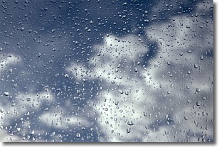
Drizzle is precipitation in the form of water droplets which are
smaller than raindrops.
Drizzle is characterized by fine, gently falling droplets and typically does not
impact human habitation in a negative way. The exception to this is freezing drizzle,
a condition where drizzle freezes immediately upon reaching earth's surface.
Freezing drizzle is still less dangerous than freezing rain, but can
potentially result in hazardous road conditions.
Next Topic: Evaporation
Weather Topic: What is Fog?
Home - Education - Cloud Types - Fog
 Next Topic: Fractus Clouds
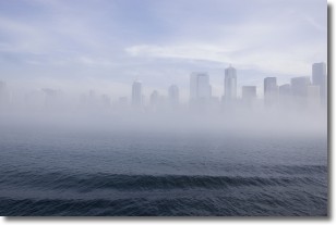
Fog is technically a type of stratus cloud, which lies along the
ground and obscures visibility.
It is usually created when humidity in the air condenses into tiny water droplets.
Because of this, some places are more prone to foggy weather, such as regions
close to a body of water.
Fog is similar to mist; both are the appearance of water droplets suspended in
the air, but fog is the term applied to the condition when visibility is less than 1 km.
Next Topic: Fractus Clouds


