Weather Alert in Arkansas
Flood Warning issued April 23 at 8:28PM CDT by NWS Little Rock AR
AREAS AFFECTED: Bradley, AR; Calhoun, AR; Union, AR
DESCRIPTION: ...The Flood Warning continues for the following rivers in Arkansas... Ouachita River At Thatcher L&D affecting Bradley, Calhoun and Union Counties. For the Ouachita River...including Jones Mill Dcp, Arkadelphia, Camden, Thatcher L&D...Minor flooding is forecast. * WHAT...Minor flooding is occurring and minor flooding is forecast. * WHERE...Ouachita River at Thatcher L&D. * WHEN...Until further notice. * IMPACTS...At 79.0 feet, Property in low lying areas needs to be removed. Access roads to oil and gas rigs may be flooded. Levee gates should be closed before the river reaches 80 feet. There is minor flooding at this level. At 80.0 feet, Minor flooding occurs at this level. Levee gates should be closed to prevent the river from backing into Calion Lake. Access to oil and gas rigs and to timber is flooded. There is wide coverage of flooding in the river bottoms. At 83.0 feet, Access to oil and gas rigs and to timber is flooded. Calhoun County Road 131 is completely under water leading to old Lock 8 river access. * ADDITIONAL DETAILS... - At 7:30 PM CDT Wednesday the stage was 83.2 feet. - Forecast...The river is expected to fall to 80.0 feet Monday evening, April 28. - Flood stage is 79.0 feet. - http://www.weather.gov/safety/flood
INSTRUCTION: Turn around, don't drown when encountering flooded roads. Most flood deaths occur in vehicles. River forecasts are based on current conditions and rainfall forecasted to occur over the next 24 hours. During periods of flooding...Evening forecasts are reissued with updated rainfall forecasts. Observed and forecasted stage data plots are available on our Advanced Hydrologic Prediction Service web page at... www.weather.gov/lzk Under the Current Conditions section...Select River and Lakes AHPS. The next statement will be issued Thursday evening at 830 PM CDT.
Want more detail? Get the Complete 7 Day and Night Detailed Forecast!
Current U.S. National Radar--Current
The Current National Weather Radar is shown below with a UTC Time (subtract 5 hours from UTC to get Eastern Time).

National Weather Forecast--Current
The Current National Weather Forecast and National Weather Map are shown below.

National Weather Forecast for Tomorrow
Tomorrow National Weather Forecast and Tomorrow National Weather Map are show below.

North America Water Vapor (Moisture)
This map shows recent moisture content over North America. Bright and colored areas show high moisture (ie, clouds); brown indicates very little moisture present; black indicates no moisture.

Weather Topic: What is Condensation?
Home - Education - Precipitation - Condensation
 Next Topic: Contrails
Condensation is the process which creates clouds, and therefore
it is a crucial process in the water cycle.
Condensation is the change of matter from a state of gas into a state of liquid,
and it happens because water molecules release heat into the atmosphere and
become organized into a more closely packed structure, what we might see as
water droplets.
Water is always present in the air around us as a vapor, but it's too small for
us to see. When water undergoes the process of condensation it becomes organized
into visible water droplets. You've probably seen condensation happen before on the
surface of a cold drink!
Next Topic: Contrails
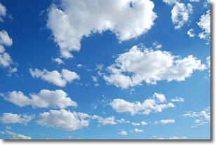
Weather Topic: What are Cumulonimbus Clouds?
Home - Education - Cloud Types - Cumulonimbus Clouds
 Next Topic: Cumulus Clouds
The final form taken by a growing cumulus cloud is the
cumulonimbus cloud, which is very tall and dense.
The tower of a cumulonimbus cloud can soar 23 km into the atmosphere, although
most commonly they stop growing at an altitude of 6 km.
Even small cumulonimbus clouds appear very large in comparison to other cloud types.
They can signal the approach of stormy weather, such as thunderstorms or blizzards.
Next Topic: Cumulus Clouds
Current conditions powered by WeatherAPI.com


