Weather Alert in California
Winter Weather Advisory issued March 13 at 1:57PM PDT until March 14 at 11:00PM PDT by NWS Reno NV
AREAS AFFECTED: Greater Lake Tahoe Area; Greater Lake Tahoe Area
DESCRIPTION: ...THE CURRENT WINTER STORM WARNING HAS BEEN REPLACED WITH A WINTER WEATHER ADVISORY AND WILL BE VALID THROUGH 11 PM PDT FRIDAY... * WHAT...Snow. Snow accumulations 6 to 14 inches with locally higher amounts up to 18 inches along the Sierra crest. For the eastern shore of Tahoe: snow accumulations 2 to 6 inches. Ridge winds gusting as high as 60 mph. For Lake Tahoe: southwest winds 15 to 25 mph gusting up to 40 mph with waves 2 to 3 feet. * WHERE...Greater Lake Tahoe Area. * WHEN...Until 11 PM PDT Friday. * IMPACTS...Travel could be very difficult at times. The hazardous conditions could impact the peak commutes through Friday evening. Tree limbs could be blown down and a few power outages may result from gusty winds. * ADDITIONAL DETAILS...There will be a brief break in the snowfall late tonight through early Friday morning. During that time, temperatures will remain below freezing which may lead to slippery and icy roads.
INSTRUCTION: Slow down and use caution while traveling. The latest road conditions for the state you are calling from can be obtained by calling 5 1 1.
Want more detail? Get the Complete 7 Day and Night Detailed Forecast!
Current U.S. National Radar--Current
The Current National Weather Radar is shown below with a UTC Time (subtract 5 hours from UTC to get Eastern Time).

National Weather Forecast--Current
The Current National Weather Forecast and National Weather Map are shown below.

National Weather Forecast for Tomorrow
Tomorrow National Weather Forecast and Tomorrow National Weather Map are show below.

North America Water Vapor (Moisture)
This map shows recent moisture content over North America. Bright and colored areas show high moisture (ie, clouds); brown indicates very little moisture present; black indicates no moisture.

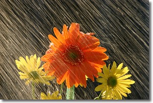
Weather Topic: What is Rain?
Home - Education - Precipitation - Rain
 Next Topic: Shelf Clouds
Precipitation in the form of water droplets is called rain.
Rain generally has a tendency to fall with less intensity over a greater period
of time, and when rainfall is more severe it is usually less sustained.
Rain is the most common form of precipitation and happens with greater frequency
depending on the season and regional influences. Cities have been shown to have
an observable effect on rainfall, due to an effect called the urban heat island.
Compared to upwind, monthly rainfall between twenty and forty miles downwind of
cities is 30% greater.
Next Topic: Shelf Clouds
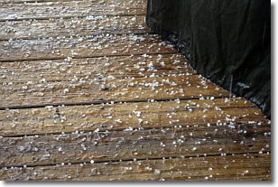
Weather Topic: What is Sleet?
Home - Education - Precipitation - Sleet
 Next Topic: Snow
Sleet is a form of precipitation in which small ice pellets are the primary
components. These ice pellets are smaller and more translucent than hailstones,
and harder than graupel. Sleet is caused by specific atmospheric conditions and
therefore typically doesn't last for extended periods of time.
The condition which leads to sleet formation requires a warmer body of air to be
wedged in between two sub-freezing bodies of air. When snow falls through a warmer
layer of air it melts, and as it falls through the next sub-freezing body of air
it freezes again, forming ice pellets known as sleet. In some cases, water
droplets don't have time to freeze before reaching the surface and the result is
freezing rain.
Next Topic: Snow


