Weather Alert in California
Avalanche Warning issued March 12 at 3:01PM PDT by NWS Reno NV
AREAS AFFECTED: Greater Lake Tahoe Area; Greater Lake Tahoe Area
DESCRIPTION: AVWREV The following message is transmitted at the request of the U.S. Forest Service Sierra Avalanche Center. BACKCOUNTRY AVALANCHE WARNING IMMEDIATE BROADCAST REQUESTED 17:00 PDT Wed Mar 12 2025 The Sierra Avalanche Center in Truckee has issued a BACKCOUNTRY AVALANCHE WARNING for the following areas: NWS Reno NV - NVZ002 (Greater Lake Tahoe)...CAZ072 (Greater Lake Tahoe (CA)) * WHAT...A period of HIGH avalanche danger and likely a natural avalanche cycle is expected in the backcountry Wednesday evening into early Thursday morning. * WHERE...Central Sierra Nevada Mountains between Yuba Pass (Hwy 49) on the north and Ebbetts Pass (Hwy 4) on the south, including the greater Lake Tahoe area. This does not include ski areas or highways where avalanche mitigation programs exist. * WHEN...In effect from Wed 17:00 PDT to Thu 06:00 PDT. * IMPACTS...Dangerous avalanche conditions are expected in the mountains due to 2 to 3 feet of rapidly accumulating snowfall along with gale force winds blowing and drifting snow. Natural avalanches are likely. Human-triggered avalanches large enough to bury or injure people are very likely. * PRECAUTIONARY / PREPAREDNESS ACTIONS...Traveling in, near, or below backcountry avalanche terrain is not recommended during HIGH avalanche danger. Consult https://www.sierraavalanchecenter.org/ or www.avalanche.org for more detailed information. Similar avalanche danger may exist at locations outside the coverage area of this or any avalanche center.
INSTRUCTION: N/A
Want more detail? Get the Complete 7 Day and Night Detailed Forecast!
Current U.S. National Radar--Current
The Current National Weather Radar is shown below with a UTC Time (subtract 5 hours from UTC to get Eastern Time).

National Weather Forecast--Current
The Current National Weather Forecast and National Weather Map are shown below.

National Weather Forecast for Tomorrow
Tomorrow National Weather Forecast and Tomorrow National Weather Map are show below.

North America Water Vapor (Moisture)
This map shows recent moisture content over North America. Bright and colored areas show high moisture (ie, clouds); brown indicates very little moisture present; black indicates no moisture.

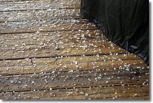
Weather Topic: What is Sleet?
Home - Education - Precipitation - Sleet
 Next Topic: Snow
Sleet is a form of precipitation in which small ice pellets are the primary
components. These ice pellets are smaller and more translucent than hailstones,
and harder than graupel. Sleet is caused by specific atmospheric conditions and
therefore typically doesn't last for extended periods of time.
The condition which leads to sleet formation requires a warmer body of air to be
wedged in between two sub-freezing bodies of air. When snow falls through a warmer
layer of air it melts, and as it falls through the next sub-freezing body of air
it freezes again, forming ice pellets known as sleet. In some cases, water
droplets don't have time to freeze before reaching the surface and the result is
freezing rain.
Next Topic: Snow
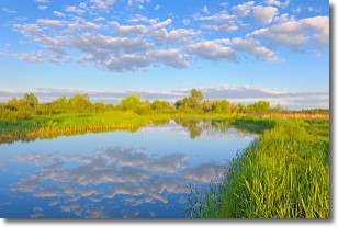
Weather Topic: What are Stratocumulus Clouds?
Home - Education - Cloud Types - Stratocumulus Clouds
 Next Topic: Stratus Clouds
Stratocumulus clouds are similar to altocumulus clouds in their
fluffy appearance, but have a slightly darker shade due to their additional mass.
A good way to distinguish the two cloud types is to hold your hand out and measure
the size of an individual cloud; if it is the size of your thumb it is generally
an altocumulus cloud, if it is the size of your hand it is generally a
stratocumulus cloud.
It is uncommon for stratocumulus clouds to produce precipitation, but if they do
it is usually a light rain or snow.
Next Topic: Stratus Clouds


