Weather Alert in Oregon
Winter Storm Warning issued March 13 at 3:51AM PDT until March 13 at 11:00PM PDT by NWS Portland OR
AREAS AFFECTED: Cascades of Marion and Linn Counties; Cascades of Lane County
DESCRIPTION: * WHAT...For the Winter Storm Warning, heavy snow. Additional snow accumulations between 4 and 8 inches. For the Winter Storm Watch, heavy snow possible. Total snow accumulations between 1 and 2 feet possible. Winds could gust as high as 40 mph. * WHERE...Cascades of Lane County and Cascades of Marion and Linn Counties. * WHEN...For the Winter Storm Warning, until 11 PM PDT this evening. For the Winter Storm Watch, from late tonight through Saturday afternoon. * IMPACTS...Roads, and especially bridges and overpasses, will likely become slick and hazardous. Roads, and especially bridges and overpasses, will likely become slick and hazardous.
INSTRUCTION: Consider postponing travel until weather conditions improve. If you must travel, be sure to slow down and allow extra time. If your car becomes trapped in deep snow, be sure to keep your car off to stay safe from potential carbon monoxide poisoning. If you are using a generator, be sure to keep it outdoors and away from windows and vents. Be aware that walking surfaces may be slick. Walk with extra care. Backcountry recreation is not advised. Winterize your vehicle and have a winter emergency driving kit readily available. Make sure your emergency kit has the following items: flashlights, batteries, blankets, a shovel, water, non-perishable food items, tire chains, etc. Now is a good time to put snow tires on your vehicle. Check on friends and family to see if they need help preparing. Monitor the latest forecasts and warnings for updates on this situation.
Want more detail? Get the Complete 7 Day and Night Detailed Forecast!
Current U.S. National Radar--Current
The Current National Weather Radar is shown below with a UTC Time (subtract 5 hours from UTC to get Eastern Time).

National Weather Forecast--Current
The Current National Weather Forecast and National Weather Map are shown below.

National Weather Forecast for Tomorrow
Tomorrow National Weather Forecast and Tomorrow National Weather Map are show below.

North America Water Vapor (Moisture)
This map shows recent moisture content over North America. Bright and colored areas show high moisture (ie, clouds); brown indicates very little moisture present; black indicates no moisture.

Weather Topic: What are Cumulonimbus Clouds?
Home - Education - Cloud Types - Cumulonimbus Clouds
 Next Topic: Cumulus Clouds
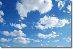
The final form taken by a growing cumulus cloud is the
cumulonimbus cloud, which is very tall and dense.
The tower of a cumulonimbus cloud can soar 23 km into the atmosphere, although
most commonly they stop growing at an altitude of 6 km.
Even small cumulonimbus clouds appear very large in comparison to other cloud types.
They can signal the approach of stormy weather, such as thunderstorms or blizzards.
Next Topic: Cumulus Clouds
Weather Topic: What is Drizzle?
Home - Education - Precipitation - Drizzle
 Next Topic: Evaporation
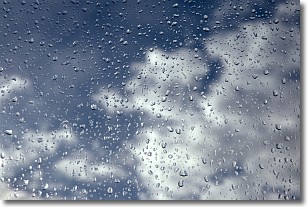
Drizzle is precipitation in the form of water droplets which are
smaller than raindrops.
Drizzle is characterized by fine, gently falling droplets and typically does not
impact human habitation in a negative way. The exception to this is freezing drizzle,
a condition where drizzle freezes immediately upon reaching earth's surface.
Freezing drizzle is still less dangerous than freezing rain, but can
potentially result in hazardous road conditions.
Next Topic: Evaporation


