Weather Alert in Minnesota
Winter Storm Watch issued March 31 at 2:23AM CDT until April 2 at 7:00PM CDT by NWS Twin Cities/Chanhassen MN
AREAS AFFECTED: Todd; Morrison; Mille Lacs; Kanabec; Stearns; Benton; Sherburne; Isanti; Meeker; Wright
DESCRIPTION: ...SPRING STORM FORECAST TO BRING HEAVY SNOW TO PORTIONS OF WESTERN, CENTRAL MINNESOTA... .Another potent Spring Storm is on tap to arrive on Tuesday lasting into Wednesday with heavy snow expected for much of central Minnesota. The system will arrive in western Minnesota by Tuesday morning with a band of heavy snow expected to begin by the afternoon continuing overnight as the system pushes eastwards. Snow quality is expected to be on the heavier, slushier side as snow ratios favor below 10 to 1. An influx of mid level warm air could also lead to a wintry mix at times, with widespread rain to the south of the main band of snowfall. Snow will diminish by Wednesday afternoon as the system continues into the Great Lakes region. A broad area of 6 or more inches of snow is expected for parts of central Minnesota, with high end amounts potentially reaching the double digits. Ice accumulations should generally remain a glaze to a few hundredths at the most. * WHAT...Heavy mixed precipitation possible. Total snow accumulations between 5 and 10 inches and ice accumulations around a light glaze possible. * WHERE...Benton, Meeker, Morrison, Sherburne, Stearns, Todd, Wright, Isanti, Kanabec, and Mille Lacs Counties. * WHEN...From Tuesday afternoon through Wednesday evening. * IMPACTS...Travel could be very difficult. The hazardous conditions could impact the Tuesday evening and Wednesday morning commutes.
INSTRUCTION: Monitor the latest forecasts for updates on this situation.
Want more detail? Get the Complete 7 Day and Night Detailed Forecast!
Current U.S. National Radar--Current
The Current National Weather Radar is shown below with a UTC Time (subtract 5 hours from UTC to get Eastern Time).

National Weather Forecast--Current
The Current National Weather Forecast and National Weather Map are shown below.

National Weather Forecast for Tomorrow
Tomorrow National Weather Forecast and Tomorrow National Weather Map are show below.

North America Water Vapor (Moisture)
This map shows recent moisture content over North America. Bright and colored areas show high moisture (ie, clouds); brown indicates very little moisture present; black indicates no moisture.

Weather Topic: What is Condensation?
Home - Education - Precipitation - Condensation
 Next Topic: Contrails
Condensation is the process which creates clouds, and therefore
it is a crucial process in the water cycle.
Condensation is the change of matter from a state of gas into a state of liquid,
and it happens because water molecules release heat into the atmosphere and
become organized into a more closely packed structure, what we might see as
water droplets.
Water is always present in the air around us as a vapor, but it's too small for
us to see. When water undergoes the process of condensation it becomes organized
into visible water droplets. You've probably seen condensation happen before on the
surface of a cold drink!
Next Topic: Contrails
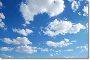
Weather Topic: What are Cumulonimbus Clouds?
Home - Education - Cloud Types - Cumulonimbus Clouds
 Next Topic: Cumulus Clouds
The final form taken by a growing cumulus cloud is the
cumulonimbus cloud, which is very tall and dense.
The tower of a cumulonimbus cloud can soar 23 km into the atmosphere, although
most commonly they stop growing at an altitude of 6 km.
Even small cumulonimbus clouds appear very large in comparison to other cloud types.
They can signal the approach of stormy weather, such as thunderstorms or blizzards.
Next Topic: Cumulus Clouds
Current conditions powered by WeatherAPI.com


